Streets · October 13, 2026
The Measured Rhythm of Cherokee Road
A pedestrian study of Eastover's central residential corridor, examining how expansive front setbacks, mature canopy trees, and classical architectural proportions establish the neighborhood's quiet, enduring civic stature.
To experience Cherokee Road from an automobile is to absorb it merely as a graceful bypass through inner Charlotte. The car registers gentle curves, rolling topography, and thick layers of deciduous foliage, but it compresses distance and flattens detail. To walk Cherokee Road, on the other hand, is an entirely different exercise. On foot, the corridor reveals itself as a deliberate composition in urban planning, where setback, elevation, and masonry assemble into one of the most coherent estate streetscapes in the American South.
Platted in 1927 by developer E.C. Griffith, Eastover was engineered from its inception to counter the rigid rectilinear grids found closer to the urban core. While Myers Park, laid out earlier by John Nolen, leaned heavily into landscape pastoralism with broad medians and winding boulevards, Griffith’s plan for Eastover leaned into spatial generosity paired with architectural discretion. Cherokee Road stands as the quintessential expression of that ethos, operating not simply as a primary thoroughfare among Eastover's leafy streets, but as the benchmark against which the rest of the neighborhood measures its scale.
The Geometry of the Setback
The defining spatial trait of Cherokee Road is its setback discipline. While newer suburban enclaves often compress houses forward to maximize rear private recreation, the historic parcels along Cherokee consistently place principal structures deep within their grounds. In many sections, residences sit sixty, eighty, or well over one hundred feet behind the sidewalk line.
This depth does more than offer seclusion to the homeowner; it produces a public benefit by creating an expansive visual foreground. The open lawn along Cherokee functions almost as a civic buffer. Rolling grades, sculpted boxwood borders, and circular pea-gravel motor courts serve as intermediate planes that guide the eye toward the facade. Because these setbacks remain relatively harmonious from one lot to the next, the block achieves a stately cadence without resorting to monotonous uniformity.
Where retaining walls exist, they are rarely abrupt or utilitarian. Low, hand-dressed granite or river stone curbs follow the natural fall of the land, holding terraces just enough to establish a clear threshold between the public right-of-way and the private estate. The transition from public sidewalk to private front door is deliberate, measured, and layered through several tiers of landscape design.
The Architectural Dialogue
Walking the length of the road brings the student of early-twentieth-century design face to face with the predominant languages of Eastover’s formative decades. Between the late 1920s and the 1950s, Cherokee Road attracted substantial private commissions that favored restrained classicism over ornamentation.
A significant portion of the primary housing stock draws from Georgian Revival precedents. These homes favor formal symmetry, executed in rich Flemish-bond red brick, topped with high-hipped or side-gabled slate roofs. Entrances are framed by pedimented porticos supported by slender Doric or Ionic columns, often topped by elegant fanlights. When reviewing the neighborhood's built environment through the lens of Eastover's classical architecture, the Georgian houses along Cherokee appear less like ostentatious monuments and more like quiet civic landmarks that have earned their permanence through material substance.
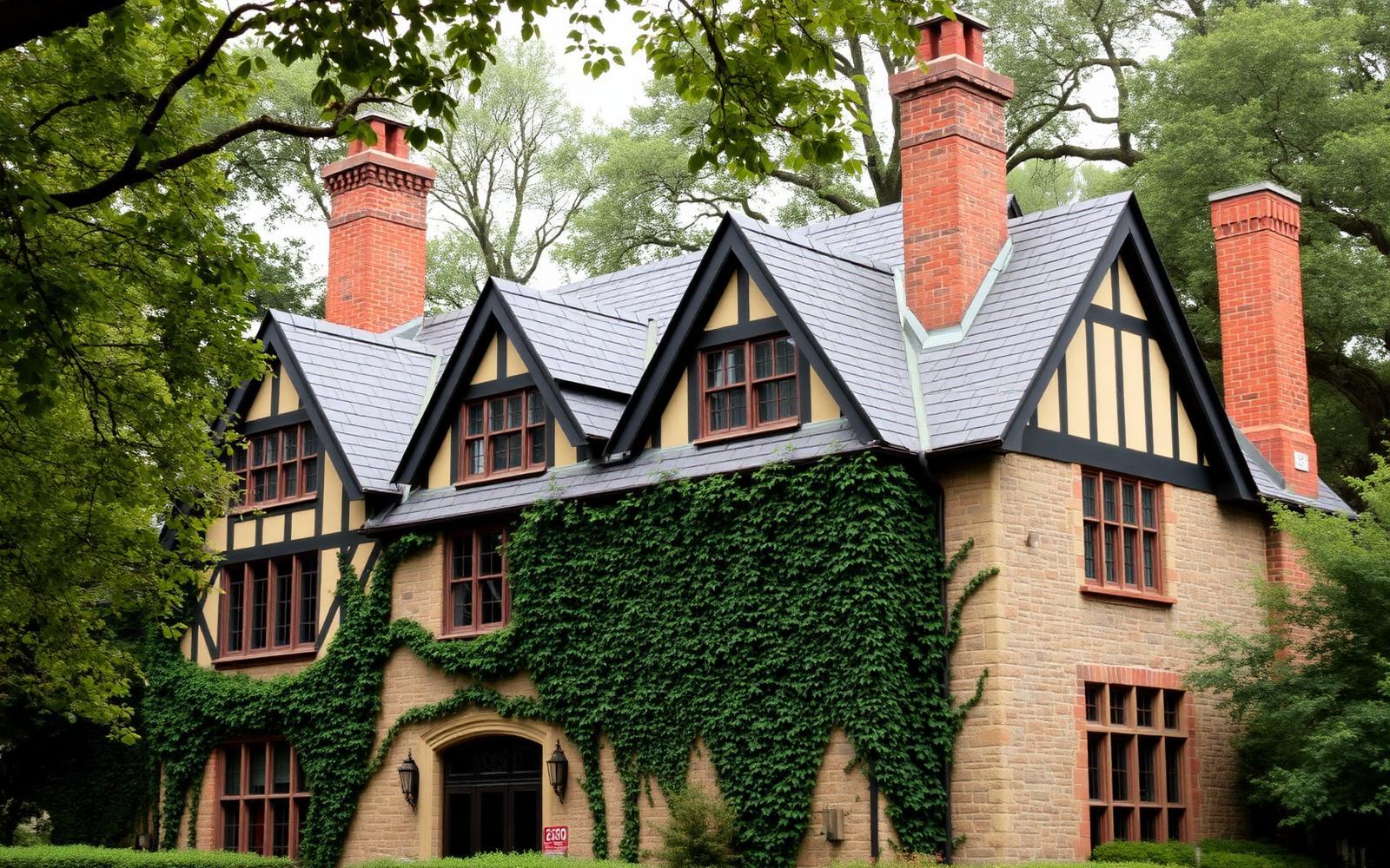
Interspersed among the Georgian manors are striking examples of Tudor Revival and Colonial Revival work. The Tudor estates introduce verticality and texture: steep cross gables, asymmetric limestone trim, patterned clinker brick, and towering decorative chimneys that punctuate the tree canopy. Yet even where styles diverge, a shared vocabulary of scale prevents discord. The rooflines, though variable in profile, maintain a consistent relationship to the height of the surrounding canopy, ensuring that no single property overwhelms its neighbor.
For those interested in the preservation of these period forms, the documentation of historic homes in Eastover reveals that many of the original 1930s floor plans along Cherokee have been carefully safeguarded. The integrity of these structures endures because their exterior envelopes were detailed with slate, copper, and hard-fired masonry—materials built to weather decades rather than market cycles.
Canopy, Topography, and the Pedestrian Experience
Topography dictates the pedestrian experience along Cherokee Road. The street rises and falls over gentle Piedmont undulations, creating natural viewing platforms. Cresting a rise, one catches glimpses of distant gables framed by willow oaks; descending into a hollow, the atmosphere becomes intensely quiet, insulated by mature magnolias, specimen dogwoods, and thick holly screens.
This natural elevation change also prevents the grand houses from appearing aloof. When a home sits slightly elevated above the grade of the sidewalk, the lawn serves as a natural plinth. When a house rests in a swale below the street grade, its rooflines nestle into the garden, diminishing the perceived mass of structures that often exceed five or six thousand square feet.
The street trees contribute as much to this rhythm as the structures themselves. Mature hardwoods form a continuous canopy overhead, casting dappled light across the brick walkways. Underfoot, the traditional herringbone or running-bond brick walks, characteristic of the neighborhood's pedestrian routes, slow the walker’s pace, inviting careful observation rather than hurried transit.
Preservation Without a District Seal
Unlike Fourth Ward or Dilworth, Eastover is not a designated local historic district. This administrative reality is frequently misunderstood by newcomers. The preservation of Cherokee Road’s rhythm does not rely on an architectural review commission issuing certificates of appropriateness. Instead, the streetscape is governed by the broader Charlotte Unified Development Ordinance (UDO) and the city's tree ordinance, supplemented by deed covenants and private stewardship.
Consequently, the corridor has not been frozen in amber. Over the past two decades, parcel consolidations, sympathetic additions, and occasional ground-up reconstructions have altered the fabric. Where contemporary projects succeed along Cherokee, they do so because the architects respect the historic rhythm of the block. They honor the established setback, mirror the horizontal-to-vertical proportions of legacy properties, and employ substantial exterior cladding.
Where additions are introduced, owners routinely invest in master-planned architectural and landscape treatments, a process explored in detail when studying thoughtful estate renovation in the area. By matching roof pitches, replicating historic mortar profiles, and avoiding garage doors that front directly onto the primary streetscape, modern builders have largely upheld the visual contract established by Griffith nearly a century ago.
The Enduring Spine
As Cherokee Road terminates near the cultural anchor of the Mint Museum Randolph at Eastover's edge, one emerges from the residential tunnel with a renewed appreciation for spatial planning. The street does not feel like an accident of modern subdivision design, nor does it carry the manufactured uniformity of master-planned developments from later eras.
It remains what Griffith conceived in 1927: a premier residential spine where civic grace and private retreat coexist. In an era when residential corridors across urban centers are routinely compromised by density pressures and out-of-scale infill, Cherokee Road continues to demonstrate the quiet power of proportion, generous setbacks, and timeless material craft.
Filed under: cherokee road, streetscapes, eastover history, residential architecture, urban design